OUTDOOR READABLE
Cool white data, restrained neon accents and decisive controls support quick reading in daylight.
 KERBPILOT PRIVATE TESTING
DEDICATED MOTORCYCLE PARKING · FOUND
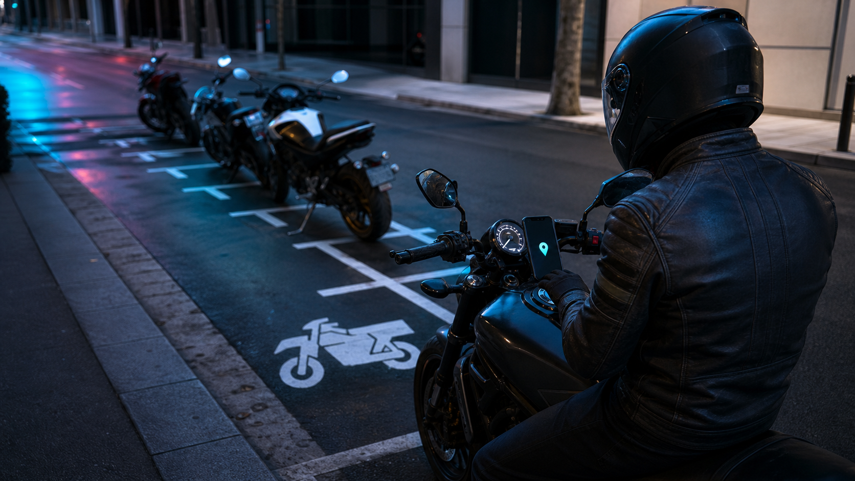
KerbPilot helps riders find dedicated motorcycle parking—not another full-size car bay. Discover known spaces nearby, get pointed in the right direction, and help every rider by contributing what you know.
THE PARKING PROBLEM
KerbPilot brings dedicated bays into one rider-focused map and nearby list. Find a known space, navigate to it, then Add, Confirm, Correct or Report records so the next rider has better information.
01
RIDE MODE
GPS-derived speed with high-contrast type, visible GPS status and layouts for portrait or landscape use. Choose metric or imperial units and an available theme.
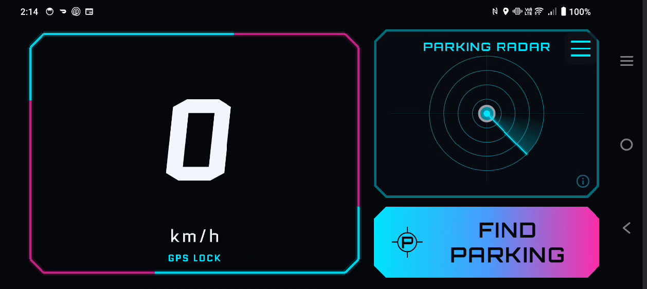
Cool white data, restrained neon accents and decisive controls support quick reading in daylight.
Above the configured cutoff—capped at 35 km/h—the radar and Find Parking control are hidden, leaving the speedometer on screen.
Metric or imperial readouts, GPS status, selectable themes, and portrait or landscape support.
02
FIND MOTORCYCLE PARKING
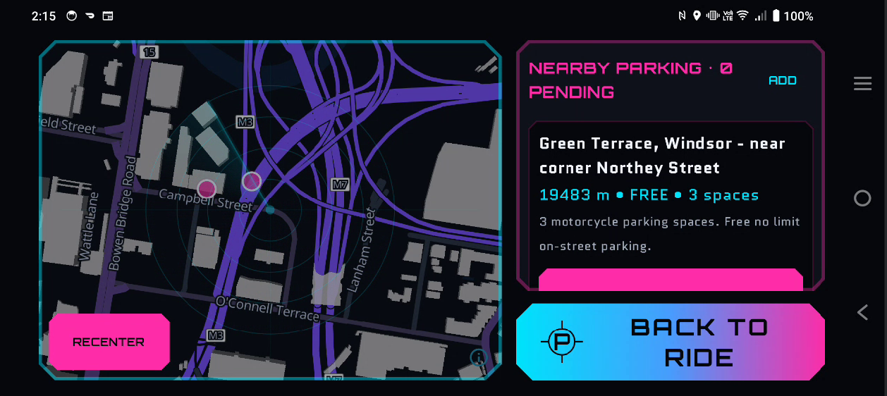
Switch from the road to a map, nearby distance-sorted records and parking details—then hand navigation to Google Maps, Waze or another selected app.
PARKING RADAR / EXPLAINED
The radar is a directional visualisation of known database locations. It does not scan for spaces, detect occupancy or show live availability.
03
COMMUNITY PARKING DATA
KerbPilot’s parking directory improves through rider contributions. Records can be pending or community-confirmed; neither status guarantees a space is legal or available now.
Share a parking location that is missing.
Reinforce a record that still matches the location.
Update details when a record has changed.
Flag an issue for review.
A record’s capacity describes the total number of known spaces. It is not a live count of open spaces.
OFFLINE-FIRST · RIDER-FOCUSED
Cached parking data remains available through network outages. Large controls, landscape handlebar layouts and strong daylight contrast keep essential actions easy to identify.
REAL APPLICATION SCREENS
Select an image to enlarge. In the viewer, use the left and right arrow keys to move between screens.
ACTIVE DEVELOPMENT
KerbPilot is under active development and private testing. The store listing will appear here when public access is ready.